
The New Era of Property Discovery on LocationOne
The way site selectors and business investors search for properties has changed. Discovery now happens earlier and with much higher expectations around speed, context, and usability. Searchers want more than a property pin on a map. They want to understand transportation access, utility infrastructure, rail connectivity, workforce context, and how a site fits into a larger regional story.
To support that process, more than 80 new GIS data layers have recently been added across the platform. Organized around Civic, Economic, Environmental, Logistics, and Utility & Infrastructure themes, the new layers mirror the categories manufacturing and industrial companies regularly evaluate during site selection.
That is why the team behind LocationOne.com continues investing in a richer search experience for both the Searcher and the Marketer. This month, we are highlighting expanded map layers, cluster mapping, and customization tools that help communities stand apart from the county and state next door. These updates improve how properties are discovered while giving economic development organizations more control over how their market is presented online.
Expanded GIS Layers Are Reshaping Economic Development Property Search
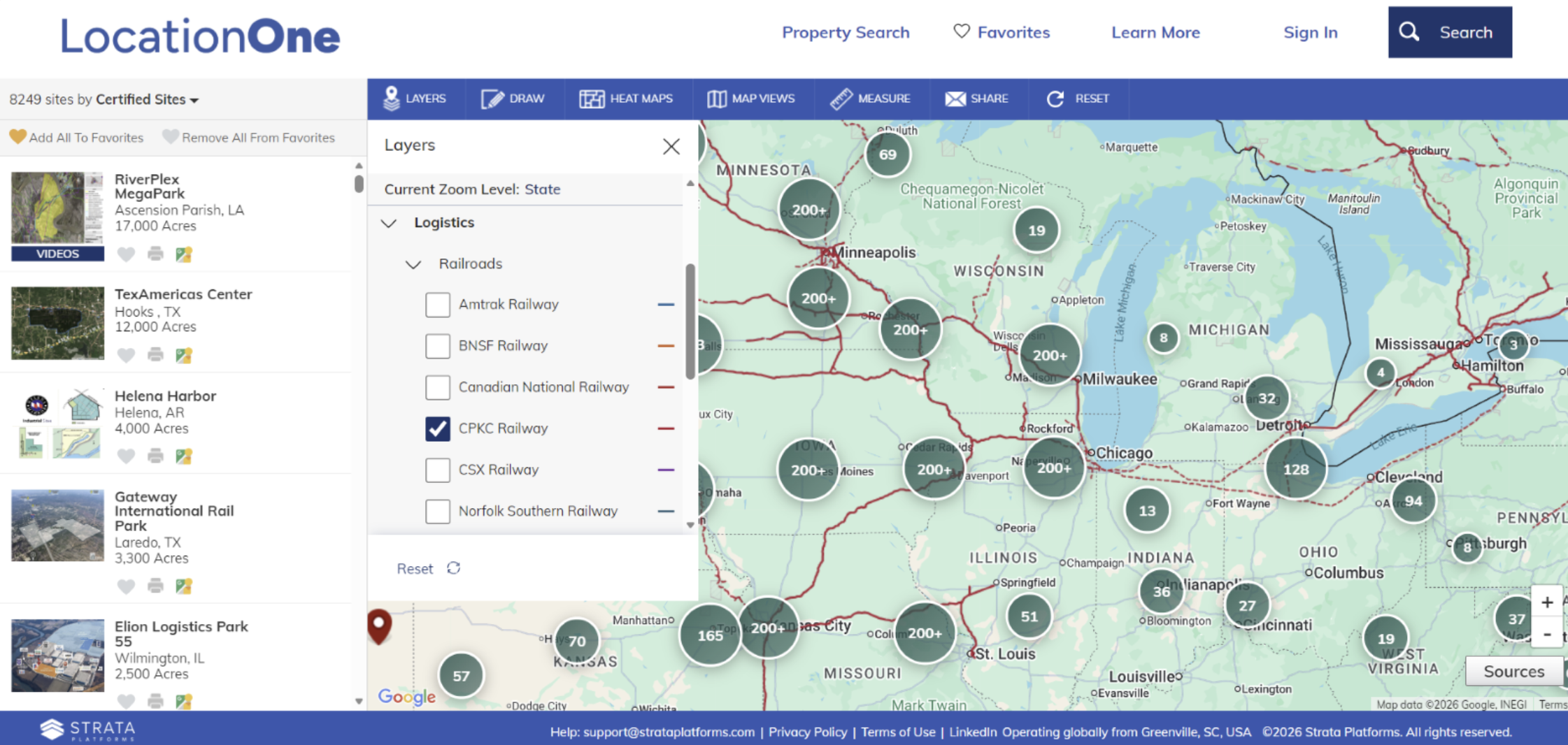
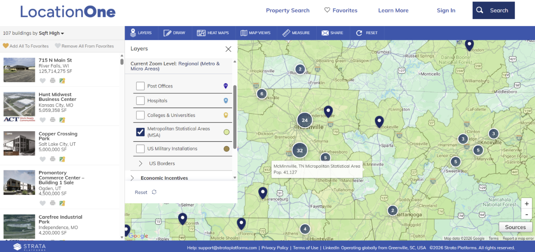
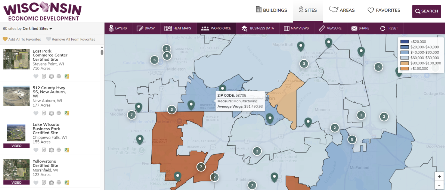
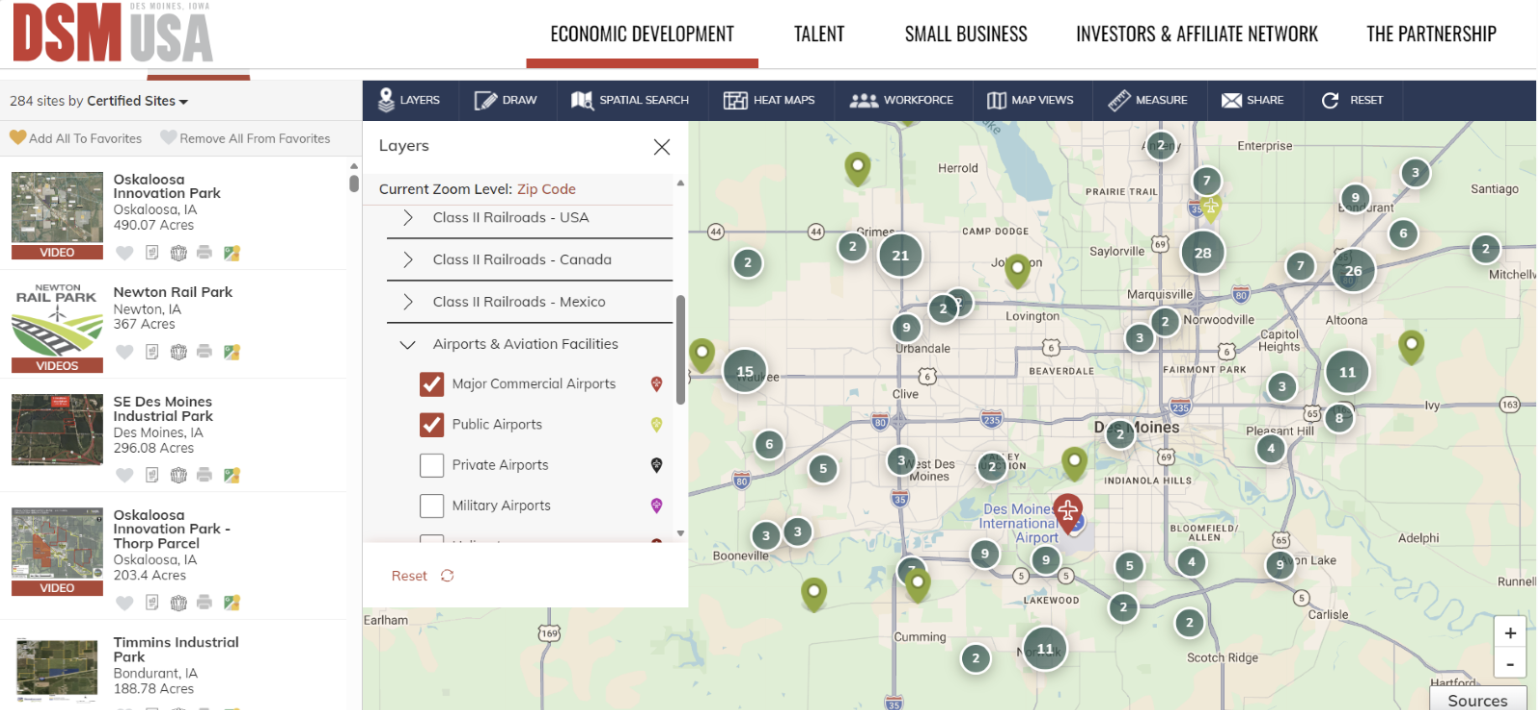
One of the biggest improvements is the expansion of map layers across both LocationOne and LOIS. Users can now explore utility territories, county lines, rail networks, school districts, transportation routes, and additional GIS layers added directly by communities themselves.
The rail network experience has also expanded significantly, including Class I and regional rail visibility across Canada, the United States, and Mexico. This matters because many industrial parks and manufacturing facilities rely on regional and short-line railroad infrastructure that can be difficult to identify early in the search process.
The goal is simple: enrich property discovery with the kind of context real site selection teams actually use during early-stage screening.
For example, users can activate Metropolitan Statistical Areas (MSAs), Opportunity Zones, military installations, rail intermodal facilities, airports, ports, and power generation infrastructure. These are often the exact types of geographic considerations investors review as they narrow regions and evaluate operational fit.
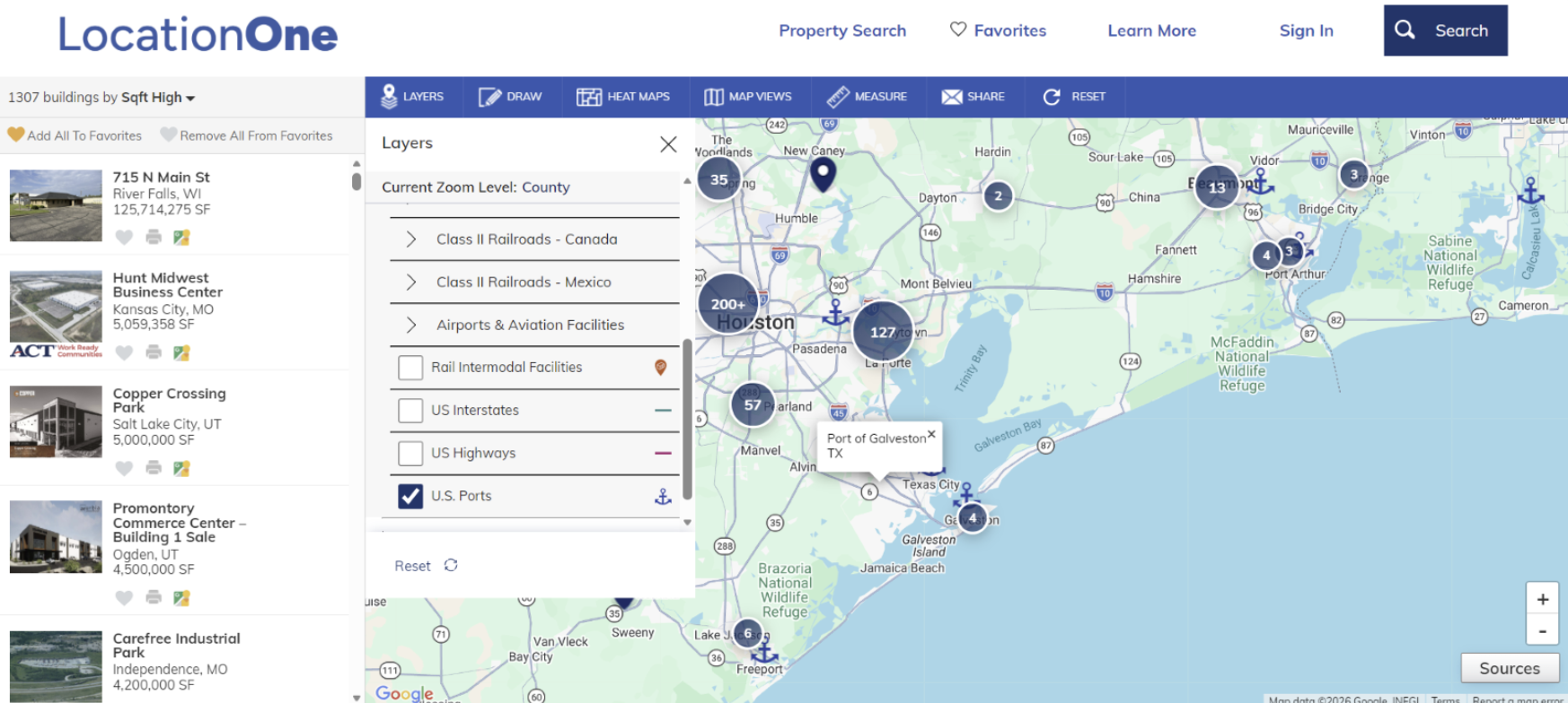
The new layer structure also makes the experience easier to navigate. Layers are grouped more intentionally, allowing users to turn information on or off depending on what matters most to their search. Instead of overwhelming users with data, the platform helps organize it in a way that supports faster determination of whether a community will be included in a site selection project’s search region.
Cluster mapping is another important enhancement. While cluster mapping may seem like a standard modern feature, it solves a very real challenge in economic development by making large property inventories easier to explore visually. The result is a cleaner, faster experience that helps users focus on opportunities instead of map clutter.
How LocationOne and LOIS Help Communities Stand Out Earlier in Site Selection
These features also support a larger story about the relationship between LocationOne and LOIS. LocationOne helps investors and site selectors discover opportunities earlier, while LOIS gives economic developers more control over how their properties, layers, and regional advantages are presented on their own website. If you have not seen LOIS in the last year, it is new and improved, with expanded mapping flexibility and stronger customization capabilities.
Organizations can select the GIS layers that best represent their strengths and even add custom local datasets over time. Every region has a different story to tell, and LOIS gives communities greater control over how those advantages are presented digitally.
We are also beginning to introduce workflow tools like Favorites, allowing users to save and organize properties as they narrow options internally. That feature will receive a deeper spotlight later this year, but it reflects where the platform is heading: supporting how modern site selection actually works. These updates are not standalone features. They are part of a larger investment into smarter discovery, better storytelling, and a stronger digital experience for the economic development industry.

Schedule a Call with Susan Donkers
If any of this feels familiar to your community, we would be glad to talk through what you are seeing and how others are approaching the same challenges.
Stay Informed
If this conversation resonates, you’ll want to stay connected.
Sign up for The Shortlist—our monthly newsletter featuring stories like this, industry insight, and practical tools designed for modern economic development and site selection.